Unlocking Sri Lanka's Investment Potential

The Client
SLTDA is the official government institution tasked with regularising the tourism industry in the country, while establishing, positioning, and developing Sri Lanka as a leading destination for international visitors. SLTDA is responsible for tapping into Sri Lanka's natural potential to expand and enhance its tourism offering while benefiting investors and supporting communities, in a sustainable manner.
Executive Snapshot
The Challenge
| Pain-Point | Impact on SLTDA | Why It Mattered |
|---|---|---|
| Fragmented datasets scattered across ministries | Weeks lost compiling due-diligence packets | Slowed investor confidence and deal closure |
| Manual status tracking via spreadsheets & email | No real-time visibility, high error risk | Missed KPIs and reporting deadlines |
| Limited global reach for state & private land | Low inbound inquiries | Under-leveraged national assets |
| No self-service for property owners | Bottlenecks at SLTDA desks | Inefficient use of staff time |
SLTDA required a creative yet technically rigorous solution that merged GIS mapping, workflow automation, and investor-centric UX—within tight public-sector compliance constraints.

The Solution
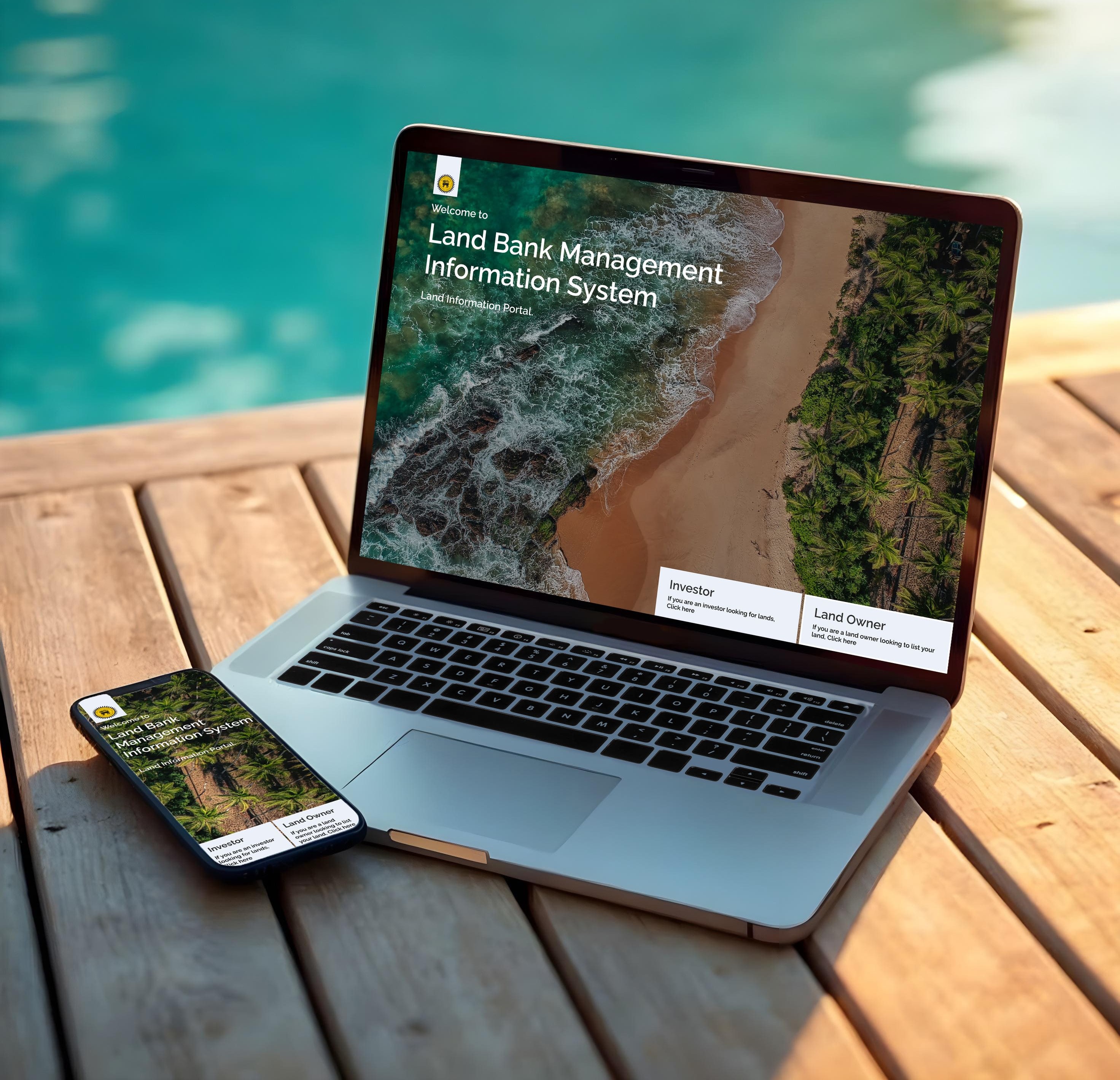
Land Bank Management Information System
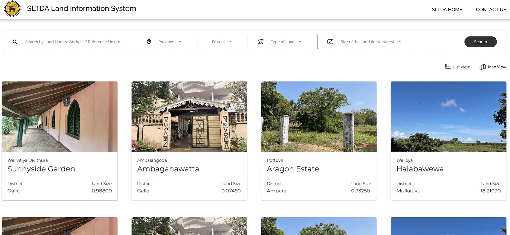
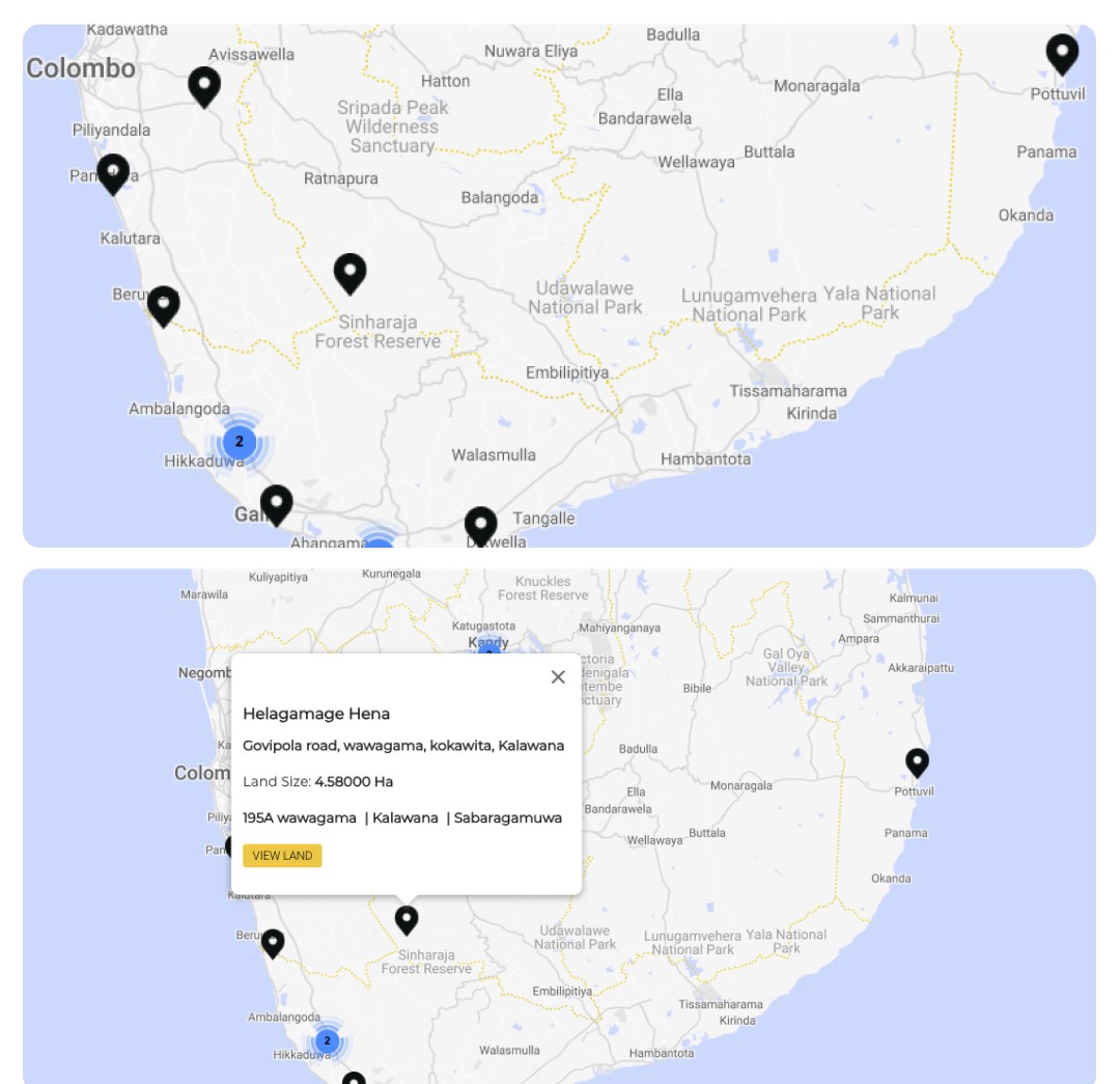
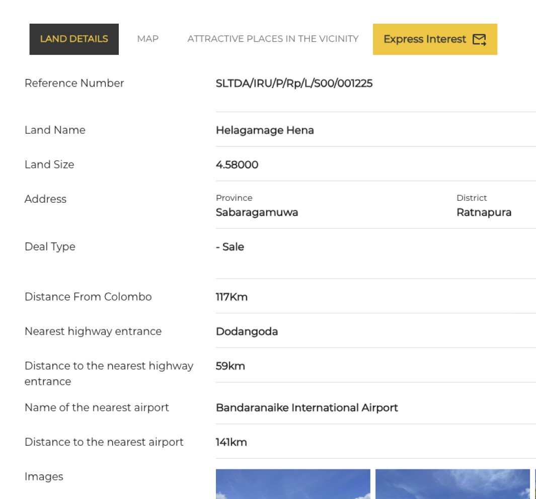
1. Investor Portal
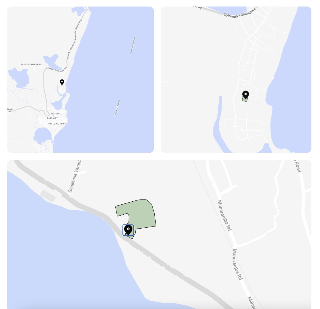
Google-style map plus faceted search to browse parcels by size, zoning, proximity to infrastructure, and projected ROI.
2.Deal Pipeline Tracker
Kanban-inspired board for officials to monitor every inquiry, proposal, and closed deal in real time.
3.Dynamic Analytics Dashboards
Auto-generated weekly, monthly, and quarterly insights (total land area listed, submission velocity, deal value, regional heat-maps).
4.Data-Collector Workspace
Intuitive admin dashboard with photo uploads, GPS tagging, and progress notifications to all user groups.
5.Role-Based Access & Audit Trails
Ensures transparency and security across public, private, and governmental stakeholders.
Results & Impact
- Significantly reduced the number of days to compile publish a land
- More land parcels listed with GIS data.
- Increase in incoming investor leads / queries.
- Increased in deals finalised per quarter.
- Staff hours saved in reporting.

What Made the Difference?
•Creativity + Engineering:
A visually compelling investment map backed by enterprise-grade architecture.
•Human-Centric Workflows:
Separate, intuitive workspaces for investors, officials, and field data collectors.
•Actionable Intelligence:
Executive dashboards turn raw data into clear policy and investment signals.
•Scalable Foundation:
Containerized services enable rapid feature rollouts and regional expansion.
Why Partner with Us?
This project showcases our ability to bridge design vision and deep technical expertise—exactly what modern governments and enterprises demand when digital transformation has real economic stakes.
Ready to transform complex data into decisive action?
Let’s build your next breakthrough.